
")
")


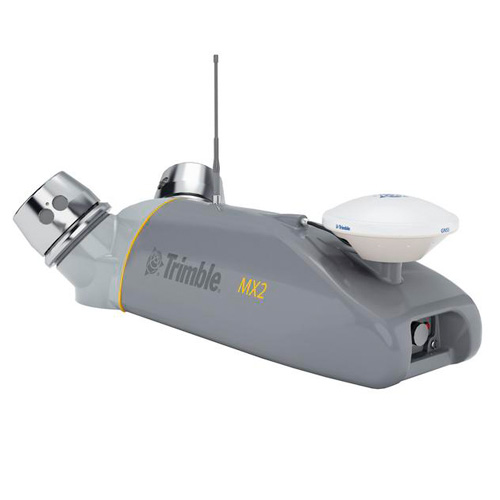
Trimble MX2 Land Mobile Mapping System
High performance laser scanner captures fully synchronized point clouds
The Trimble MX2 is a vehicle-mounted spatial imaging system which combines high resolution laser scanning and precise positioning to collect geo-referenced point clouds for a wide range of requirements. Available in single head, dual head or tilted head (MX2t), the system contains a combined Trimble Applanix GNSS and inertial geo-referencing module for precise positioning. The system can be rapidly deployed onto on- and off-road vehicles of all sizes, and significantly reduces project field time and operator skill levels compared to traditional techniques. The MX2 is supplied with Trimble's proven Trident software to rapidly extract and analyze the raw data to turn it into useful geospatial intelligence.
Features
|
Benefits
|
SoftwareThe Trimble MX2 allows you to visually observe and capture the job site, then produce deliverables in the office later using Trimble Trident and Applanix POSPac™ MMS software. Trident Imaging Hub software is available with the system and offers robust object positioning, measurement, data layer creation, 3D models and analysis of geo-referenced imagery |