


Trimble UX5 Unmanned Aircraft System
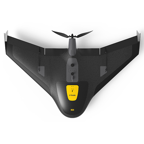
The Trimble UX5 Aerial Imaging Solution is setting the standard for fast and safe aerial data collection by offering a complete system with powerful technologies such as reversed thrust & automatic fail-safe procedures, a robust design and radically simplified workflow.
- Ensures optimal image quality along with maximum photogrammetric accuracy.
- Combines impact resistant foam structure and internal and external composite elements for extreme durability and strength.
- Design ensures employability nearly everywhere and in practically all weather conditions.
Trimble Access Aerial Imaging Application
The Trimble Access™ Aerial Imaging application loaded onto the Trimble Tablet Rugged PC operates the Trimble UX5 and is a single software tool for planning your aerial missions, performing pre-flight checks and monitoring your flights.
- Intuitive workflows ensure reliable results.
- Conduct flights in a fully automated manner, from launch to landing.
- No piloting skills required.
- Built-in safety procedures ensure safe and successful launches each time.
Image Processing
The Trimble UX5 aerial image data can now be processed into powerful deliverables with the new Trimble Business Center (TBC) photogrammetry module. Specialized computer-vision algorithms produce very accurate results automatically, with minimal manual interaction. Provides a stable and reliable photogrammetric system delivering excellent results without requiring specialized photogrammetry knowledge or experience.